
Go World Travel is reader-supported and may earn a commission from purchases made through links in this piece.
Driving through Colorado’s Rocky Mountains during leaf-peeping season is one way to catch the annual spectacle of golden aspen shimmering in the glow of the sun.
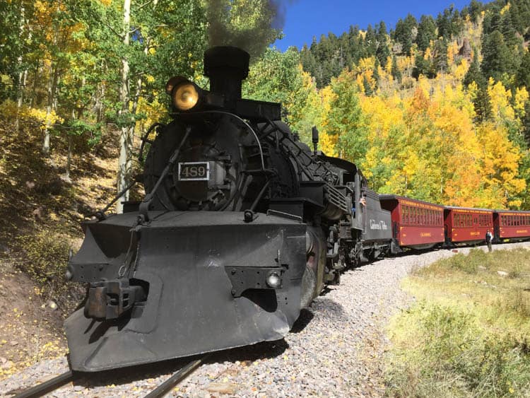
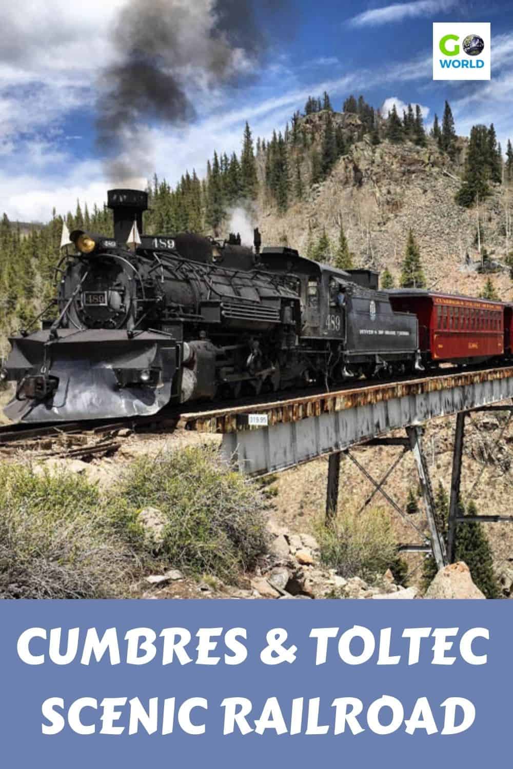
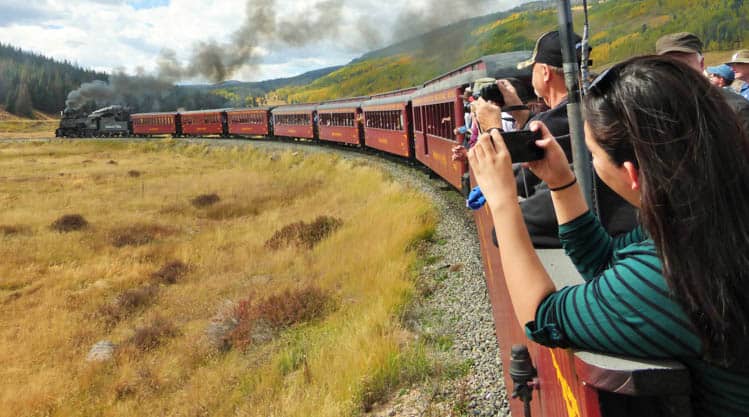
Cumbres & Toltec Scenic Railroad
But here’s a better and safer way to view the changing aspen in Colorado – take a relaxing ride on the Cumbres & Toltec Scenic Railroad based in Antonito, Colorado and Chama, New Mexico.
While driving requires effort and attention, the most work you’ll have to do on a scenic train ride is to steady your camera for that perfect fall shot. Leave the driving to the engineers and enjoy your once-a-year outing.
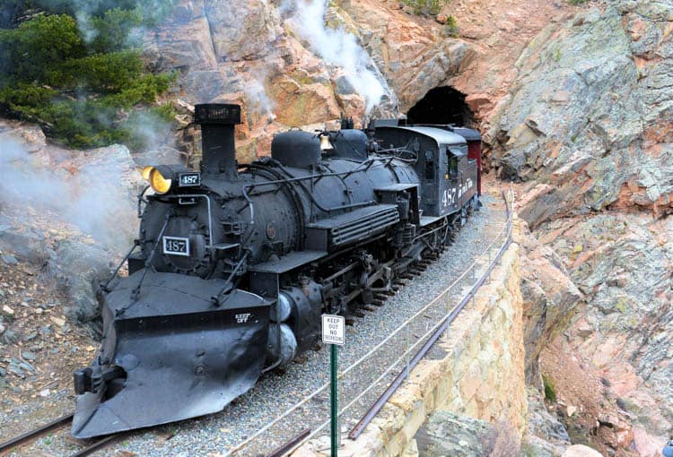
The Cumbers & Toltec train is the longest and highest of the few narrow-gauge railroads left in the country. The railroad dates to 1880 when crews laid 64 miles of track over the 10,015-foot Cumbres Pass in the San Juan Mountains and down into Chama, New Mexico.
Back in the day, railroaders knew that narrow-gauge track, which is three feet between rails, works better than the standard 48-and-a-half-inch gauge on tight mountain curves. Also, they knew the tighter tracks were better on rock cuts, steep grades and bridges.
Path of Cumbres & Toltec Railroad
Indeed, the Cumbers & Toltec track faces all of the above as It meanders across the Colorado-New Mexico border 11 times. One old-timer explained the convoluted route this way: “The surveying crews simply turned their mule loose and followed it to the summit of Cumbres Pass!”
In Southern Colorado and Northern New Mexico, there are five life zones, from the plains (4,000-5,000 feet) to the alpine tundra (above the treeline).
The train route goes from the foothills of Antonito at 7888 feet to the subalpine zone at Cumbres Pass, not quite treeline. As the train climbs, so does the opportunity to see the Aspens in all their glory.
About Aspen Trees
Aspen trees reproduce from shallow roots that spread laterally. They send up shoots to form a grove in which all trees are related.
Genetics of these groves, along with amounts of moisture, temperature and soil composition, determine when the first leaves appear in the spring and what color the leaves turn in the fall.
Aspens also produce seeds, which is why one clump will turn golden and another grove will be red. Most, however, turn yellow, and when backlit by the sun, they shimmer like a brilliant gold gem.
Cold nights, shorter days and lower amounts of sunlight aid in the process, and those in higher elevations begin to turn first. In southern Colorado and northern New Mexico, an active monsoon rain season has contributed to the vibrant colors.
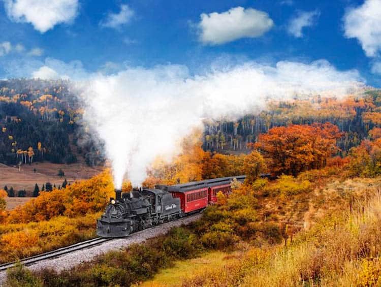
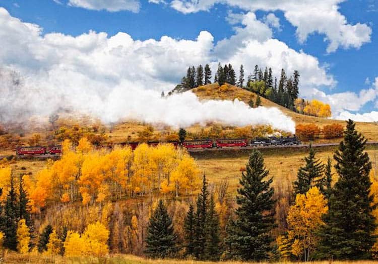
Fall Colors on Cumbers & Toltec Railroad
When you start in Antonito, you start to see Aspen groves of the Rocky Mountains at mile marker 299.4 at Big Horn Peak at about 9,000 feet. They are interspersed among Conifer, Douglas Fir, Ponderosa Pine, Scrub Oak and Piñon-Juniper trees.
A small bush that you’ll see often on the side of the tracks at this altitude is Rabbitbrush or Chamisa. It blooms bright yellow through September, adding color to the fall array.
Just before reaching Sublette, a former home for the railroad workers, the track makes two 20-degree double-S curves as it winds through the Aspen forest.
Calico Cut at mile 313.20 is an apt description for the rusty-red, orange, purple, maroon and tan-colored weathered rock that make up the side of the mountain. Together with the fall foliage, including Scrub Oak that turn shades of yellow, orange and red, this is the most colorful spot on the path.

The view of Toltec Gorge, a rocky chasm 600 feet deep and 800 feet across, pops up quickly at mile 315.3, so be ready. It’s spectacular! Below it Rio de los Pinos (river of the pines) is a constant along much of the route.
Across the valley here, patches of gold and orange dot the landscape like a quilt covering the mountainside.
From here to Osier, where the train drops passengers off for lunch, the Aspens are abundant, enveloping you in a sun-splashed forest of gold and yellow. Osier was a toll station on the road from Conejos to Chama before the railroad went in.
Today it’s a shelter offering cafeteria-style lunch and bathrooms for the riders. Old wooden cattle pens still stand as a reminder of the townsite.
Cumbres Pass
As the train chugs up to its highest point at 10,015 feet, I think of the children’s book The Little Engine That Could. Chuga-chuga-chuga, chuga-chuga-chuga. . .at this altitude, winter snow drifts reach 20 feet.
It’s hard to imagine, but railroad families lived here through the rough winter. It’s the highest pass of any railroad in the country.
At mile 342.50, the grade turns to four percent. This means that for every 100 feet the train moves forward, it climbs four feet vertically. Here begins the steep descent into the Chama Valley decorated with brilliant Aspens, or the steep climb out of the valley going the other way.
In the early 1970s, millions of caterpillars infected the Aspen trees around the Lobato Trestle. They killed acres and acres of Aspens, leaving their larvae in a nest on the branches.
When the insects hatched, they fell onto the rails, making them too slippery for the locomotives to keep traction on the steep grade. So the engineers devised an old-school method of removing the squirming worms.
Two people sat on each side of the front of the engine with brooms, and as the train chugged forward, they swept the rails clean!
San Luis Valley
We stayed in Salida, a historic mountain town in the Collegiate Peaks area. From there we drove almost two hours south to Antonito for our 10 a.m. boarding.
The drive on Hwy 285 and then Hwy 17 took us through the beautiful, agriculturally rich San Luis Valley, the second-largest producer of potatoes in the country (after Idaho). It’s also the largest high alpine valley in the world, bordered on the west by the San Juan Mountains and on the east by the Sangre de Cristo range.
Here is the home of the amazing Great Sand Dunes National Park, which we have visited many times. On the way back to Salida, we caught the famous “Sangre Sunset,” when the setting sun envelopes the mountains in a reddish-pink glow.
Hence, the name bestowed by Spanish settlers, which means “blood of Christ.”

![]()
If You Go on The Cumbres & Toltec Scenic Railway
Cumbres & Toltec Scenic Railroad offers a variety of full-day and half-day trips and three classes of service. You can start your railroad journey at either Antonito or Chama. For a complete list of schedules and fares, visit cumbrestoltec.com.
Find hotel or VRBO accommodations, insider knowledge on the best local restaurants, hiking tips and more through TripAdvisor and Travelocity. Book your flights to Antonio or Chama at the best rate with seasonal promotions through CheapOair.
Author Bio: Claudia Carbone is an award-winning travel writer based in Denver. Read more on her travel blog.

- Gateway to Wilderness: A Guide to Historic Lodges in Yellowstone National Park - April 19, 2025
- Visiting West Point: How to Navigate Your Way to and Around the Iconic Military Academy - February 4, 2023
- Sleeping on The Wharfside, Floating Bed and Breakfast Docked on San Juan Island - December 18, 2022