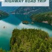
The North Cascades Highway cuts through some of America’s most dramatic mountain scenery, earning its nickname as the gateway to the “American Alps.”
This 140-mile stretch of Highway 20 winds through Washington State’s rugged North Cascades National Park, home to more than 300 glaciers—the most in the Lower 48.
From the western starting point in Sedro-Woolley to the eastern terminus in Twisp, travelers encounter towering snow-capped peaks, pristine alpine lakes, and cascading waterfalls that define the Pacific Northwest landscape.
When to do the North Cascades Highway Road Trip
The best time to do this drive is from May to October, when longer daylight hours and weather conditions are best. However, what makes this drive truly special is how dramatically it changes with the seasons, each offering its own compelling reasons to make the journey.
Whether you’re drawn by autumn’s fiery display of color, spring’s wildflower awakening, summer’s endless daylight and accessible high country, or winter’s pristine solitude, the North Cascades Highway delivers an experience that rivals any scenic drive in America.
While the high-elevation sections close during winter months, the accessible portions of this remarkable road provide year-round opportunities to witness one of the continent’s most spectacular mountain environments.
Spring
Spring brings the appearance of bright green leaves and budding flowers, as the North Cascades Highway shakes off winter’s grip. Snowmelt feeds countless waterfalls that cascade down rocky cliffs and the air smells fresh with warming earth and new growth.
The contrast is striking—snow still caps the high peaks while the valleys below come alive with color. It’s an ideal time to experience the transition from winter to the growing season, with fewer crowds than summer but more accessible trails than the snowy months.
Summer
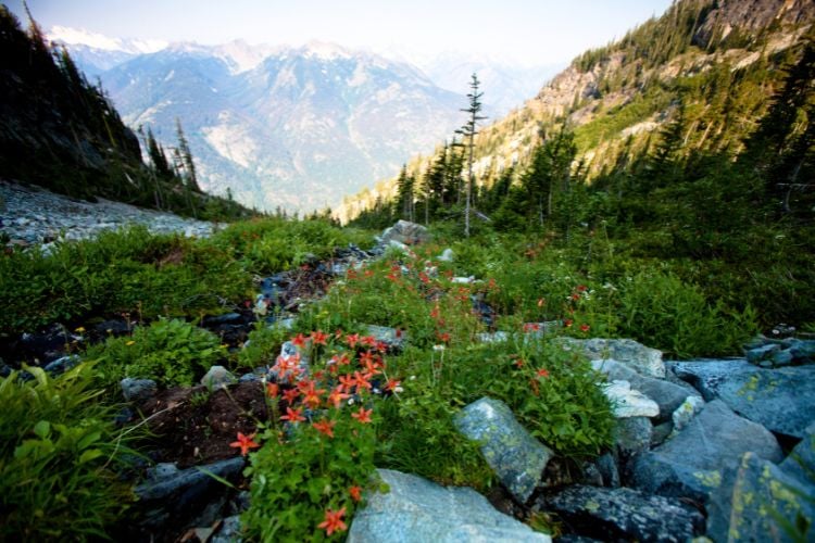
Image by epicurean from Getty Images Signature via Canva
Summer opens up the full 140-mile highway, giving travelers access to the complete North Cascades experience. Alpine lakes reflect clear blue skies, hiking trails lead to meadows of wild flowers, and the long daylight hours—with sunset as late as 9 PM—provide plenty of time for exploration.
Wildlife is active, from black bears foraging for berries to mountain goats navigating steep cliff faces. The weather is generally reliable, making it the best season for camping, serious hiking, and photography.
Every scenic pullout offers views that justify the drive, whether you’re looking at glaciated peaks or deep forest valleys.
Fall
Autumn in the Pacific Northwest is a carnival of colors as the trees start dressing in their fall finery. It’s a peak time to be in the mountains to witness alders and cottonwoods dropping butter-yellow leaves and maples showcasing their brilliant red and lime-green leaves.
Golden larches glow among the evergreens on the lower slopes, and the surrounding meadows are on fire with huckleberry bushes turning burgundy. Who could resist taking the North Cascades Highway, also called Highway 20, in Washington State in the fall?
Winter
Winter tells a different story entirely. Highway 20 typically closes east of the Cascades from November through April, limiting access but creating opportunities for those willing to explore on snowshoes or cross-country skis.
The western sections that remain open offer a quiet, snow-covered landscape where ancient trees stand draped in white and frozen waterfalls create ice sculptures along the roadside.
It’s a season for solitude and winter sports, with far fewer visitors but rewards for those who make the effort to experience the Cascades in their most pristine state.
Begin Your Journey in Seattle
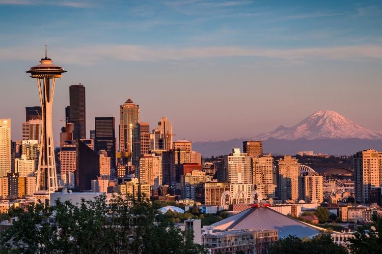
The highway is a picturesque segment of the state’s Cascade Loop, a 430-mile drive that takes around 9 ½ hours to drive straight through. If you take the loop, start in Seattle and head north towards Everett.
You’ll want to stop to breathe the salty sea air in cities like Oak Harbor, Langley or Anacortes. They’re on some of the islands you’ll navigate. This route, best covered in five to 10 days, offers engaging experiences whether you’re a rock climber, bird watcher, photographer, hiker or sightseer.
North Cascades Highway

Photo by Marcia McGreevy Lewis
We’re going to concentrate on the North Cascades Highway section of the loop (Highway 20) because its allure is soaring snow-capped peaks, forested valleys and charming towns. The lake-dotted terrain, lofty cedars and firs with velvet fronds will wrap you into the scenic panorama.
To take this portion of the Cascade Loop, start from Seattle, where it’s about a 1 ½ hour drive to approach the North Cascades Highway. Your 140-mile journey into the “American Alps” begins in Sedro-Woolley in the West and ends with the quaint town of Twisp in the East. Head east off Interstate 5 to take Highway 20 at Sedro-Woolley.
North Cascades National Park
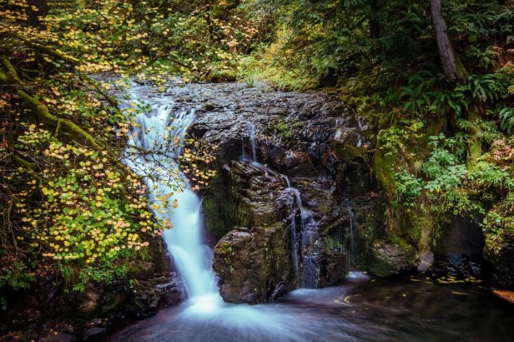
Image by Arpad Jasko from Getty Images via Canva
The North Cascades Highway is a picturesque winding road that runs through the northern part of Washington State. Most of the highway is in the North Cascades National Park, a sprawling, glacier-filled wilderness area.
Wildlife explodes here with butterflies, peregrine falcons, herons, eagles, bats, ducks, salmon, wolves, wolverines and bears. There is no fee to enter the park, and it remains open year-round, offering a variety of recreation opportunities, including hiking, fishing, boating, skiing, snowshoeing and wildlife viewing.
Plan a weekend getaway or, even better, an extended road trip to stop along the way to relish lush cascading waterfalls, old-growth forests and the refreshing aroma of cut hay and farmland in the Methow Valley.
Some of the stops include the visitor center in Newhalem, where there is a new film and a wheelchair-friendly trail, a convenient leg stretcher.
Newhalem is a company town founded in the early 20th century to house workers building the Skagit Hydroelectric Project. The project includes three dams and powerhouses.
Views, Waterfalls and Wildlife

Image by jtstewartphoto from Getty Images Signature via Canva
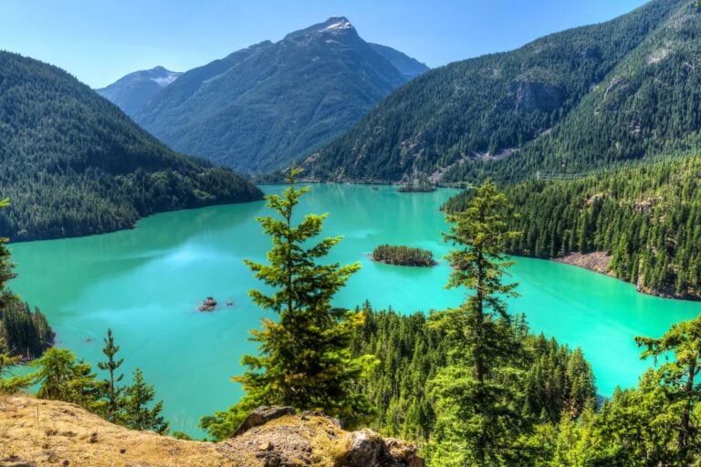
Another stop is the Diablo Lake Overlook, where you can observe the lake’s stunning turquoise color. Glaciers feed the lake, grinding rock into fine silt as they advance. The silt, suspended in the lake, gives the water its color.
Some days it’s deep blue, depending on how sunny the day is. You can fish on the lake or hike from the Ross Dam Trailhead. For a thrill, drive across the 389-foot Diablo Dam.
Gorge Creek Falls is one of the most accessible among the abundant waterfalls. A short paved path along an interpretive trail leads to a dramatic viewpoint next to the highway. There’s also a 0.8-mile loop trail leading to views of the Skagit River Gorge and Gorge Lake.
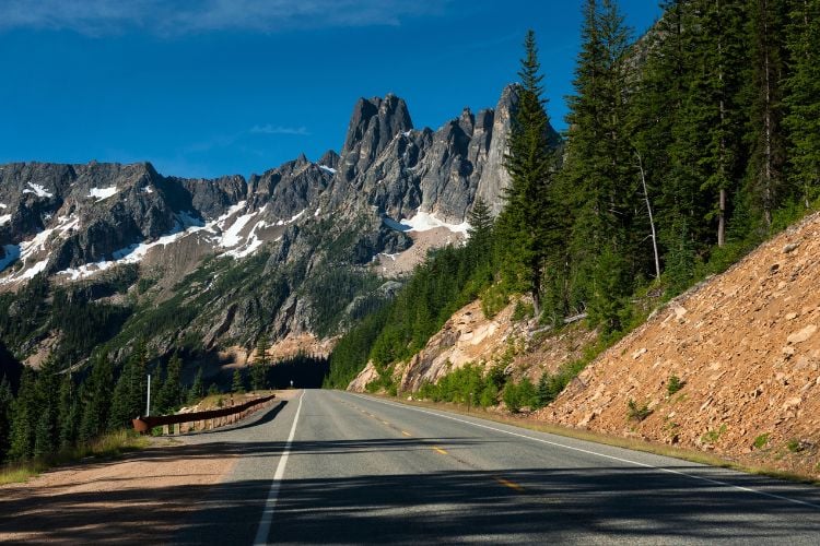
You can drive right up to most scenic spots in the park, and the best of them is the Washington Pass Overlook, the highest point along the North Cascades Highway at an elevation of 5477 ft., where you’ll feel like you’re standing on top of the world.
The overlook is after the famous hairpin turn at the base of Liberty Bell Mountain. There is a parking accessible and has an almost 360-degree view of Liberty Bell Mountain, Kangaroo Ridge, and the massive peaks that jut above Early Winters Creek.
Ross Lake offers one of the largest populations of bald eagles in the United States. Eagles arrive in the late fall to feed on salmon carcasses along the Skagit River, the largest wintering population of bald eagles in Washington State.
Launch your boat or join a river outfitter. Enjoy camping at Rasar, Howard Miller Steelhead Park and Forest Service campgrounds along the Cascade, Sauk and Suiattle Rivers.
Cute Towns to Visit Along the Way

There are three captivating towns in the Methow Valley as you head east. Mazama has a population of 200 people and a handful of businesses. It’s a hub for outdoor recreation with its access to rock climbing, hiking, fishing, horseback riding, cross-country skiing and biking.
This is where you can arrange multi-day adventures. You can also access the Pacific Crest Trail to Cutthroat Pass at the Rainy Pass Trailhead Road between Diablo and Mazama. That’s a comfortable day hike.
Twisp is significantly larger than Mazama, with a population of 992 residents. Its picturesque setting at the confluence of the Twisp and Methow rivers belies its designation as the smallest creative district in Washington State. The galleries, outdoor art sculptures and year-round arts events keep that pronouncement honest.
You’re in the West, so shouldn’t there be a town with wooden boardwalks and the oldest legal saloon in Washington State? That’s Winthrop, known for the American Old West design of all its charming buildings. It’s also a cross-country skiing site, with over 120 miles of groomed trails.
The Remote Village of Stehekin

Now you’re through the North Cascades Highway, but there’s one more spot you might want to consider on the eastern side of the highway: Stehekin, whose allure is its seclusion. The only way in and out is by boot or boat, so time has stopped.
Nestled at the headwaters of Lake Chelan, the Stehekin community lives life a little slower, and that means it offers visitors an escape from the bustle of daily life. The roughly 90 year-round residents manage what few dining and overnight places exist.
This remote village, with its old cars, is a refreshing throwback to a bygone era that offers historical, cultural, and outdoor activities, connecting you with its majestic surroundings.
You can hike the scenic 23-mile from Highway 20 to High Bridge, where you hop on the red bus to Stehekin. Most travelers take the Lady of the Lake ferry from Chelan. Make lodging reservations before arriving in Stehekin.
There are campgrounds and backcountry camps, but there is no cell phone reception. Many businesses accept credit cards, but grocery and food services are sparse. Get around Stehekin by foot, bike or hop on the antiquated red bus.
In fall, early snow may be dusting the jagged peaks, and the azure alpine lakes will take your breath away. Go before the highway closes for the winter.
If You Go:
- The best time to go is late May to early October. The high-elevation sections close during winter.
- Check the current road conditions with Washington State Department of Transportation.
- There are few gas stations.
Where to Stay
- Lake Diablo: North Cascades Institute is affordable and includes meals
- Winthrop: Sun Mountain Lodge
- Twisp: Casia Lodge and Ranch
- Other accommodation options
Where to Camp
- Colonial Creek
- Goodell Creek
- Newhalem Creek
Where to Eat
- Winthrop: Sun Mountain Lodge
- Twisp: Casia Lodge and Ranch
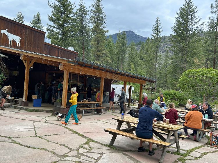
- Mazama: Goat’s Beard
Tour and Trail Suggestions
- Lake Diablo boat tour—reserve at ncascades.org
- Hike—all trailheads are fee-free; some camping is available & permits may be required:
- Cascade Pass/Sahalee Arm
- Thunder Creek Trail
- Rainy Pass Trailhead
- Hidden Lake Lookout
- Ruby Creek
- Wing Lake-rugged
- Copper Ridge and Chillawack River trails-challenging
Learning Centers
- North Cascades Institute at Lake Diablo Environmental Learning Center
- American Alpine Institute—based in Bellingham, WA, skills courses and summit attempts
Need a hand planning your trip? Here are the sites and services we rely on most, from booking tools to travel products we love.
Inspire your next adventure with our articles below:
Author Bio: Marcia McGreevy Lewis (she/her) lives in Seattle and is a retired feature writer for a Washington newspaper. She has written for literary journals, magazines, travel sites and books. Reach her on Facebook and Instagram: marcialewis25, Twitter: @McGreevyLewis, and LinkedIn: marcia-lewis. Clips: gravatar.com/profile/about Display name: mmcgreevylewis
Want to discover more hidden gems and helpful travel tips? Join our free newsletter for the latest travel secrets and travel articles.
We are reader-supported and may earn a commission on purchases made through links in this article.