
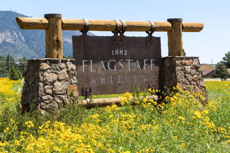
The heat hit us before we even stepped outside as the doors at Phoenix Sky Harbor International Airport slid open. It was 117 degrees under a blazing sun.
My wife, Nataliya, and I had flown in from Baltimore with our grown kids, Nicole and Alex. We make this trip every year, but we never stay in Phoenix. About a decade ago, my brother, Rob, moved north to Flagstaff, and my parents followed soon after. Phoenix is the place where the big planes land.
“Are we going to survive 100+ sunshine?” Nataliya asked, one hand still on her suitcase.
“Not for long,” I said. “Flagstaff is up in the mountains. It’ll be 30 degrees cooler by dinner.”
“I’ll believe it when I see it,” Nicole said, fanning herself with her boarding pass.
Interstate 17 heads north out of the Valley of the Sun through the classic Sonoran Desert. Saguaro cacti lined the highway with their arms in the air, as if the heat itself had told them, “This is a stick-up!”
Past Black Canyon City, the road began to climb, and the number on the dashboard thermometer began to fall. We stopped at the Sunset Point rest area for the view over Black Canyon toward the Bradshaw Mountains, the desert we had just left already hazy and far below.
Past Camp Verde, the highway climbed the Mogollon Rim, and the desert gave way to forest. By Munds Park, we were deep in the ponderosa pines of Coconino National Forest, part of one of the largest ponderosa forests in the world. The trees stood tall and straight, bark glowing dark amber in the late afternoon sun.
Nataliya rolled down her window. “Smells like Flagstaff.” On a warm day, ponderosa bark smells faintly of vanilla.
When we pulled into my parents’ driveway, the dashboard read 82.
Home in the High Country
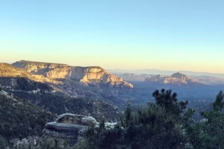
Flagstaff sits among the pines, the San Francisco Peaks on display in the distance. The peaks turn pink in the fading light and the temperature slides into the 60s.
In winter, those peaks turn white, and so does everything else. Flagstaff averages roughly 90 to 100 inches of snow a year, enough to rank among the snowiest cities in the country.
During our first night, we sat outside and gazed up. The Milky Way stretched across the sky above the treetops, brighter than any of us had seen it back home in Maryland. In 2001, Flagstaff became the world’s first International Dark Sky City, and it keeps its outdoor lights low and capped, so light radiates down rather than up, to protect the view.
After an evening of stargazing, Rob showed up for breakfast and conversation, and with a plan.
“Thunderstorms are expected later today,” he said. “We’ve got a window before the clouds roll in. Let’s go for a hike.”
Mount Elden: Manageable Suffering
Mount Elden rises about 2,400 feet above the northeast side of Flagstaff, a big lava dome you can see from almost anywhere in town. The Elden Lookout Trail climbs to the top in about 3 miles.
“Easy start,” Rob said over his shoulder.
“More like manageable suffering,” Nataliya said.
Near the bottom, we took a detour around Fatman’s Loop, a 2.5-mile loop named for a narrow gap between boulders. Nicole slipped through first, with Alex and Rob right behind her. Nataliya and I went last, at a dignified pace.
Along the loop, small holes and cracks in the rocks held fragments of ancient pottery. The Sinagua people built a village at the foot of this mountain about 900 years ago, and bits of their everyday lives still turn up along the trail.
The rule is to look and leave them where they are. Nicole crouched for a closer look at one shard, and I crouched beside her.
“That probably used to be someone’s everyday coffee mug,” Nicole mused.
Higher up, the switchbacks climbed through young aspen and the silvery trunks left by the 1977 Radio Fire. From the summit, crowded with radio towers and an old fire lookout, the view took in the San Francisco Peaks to the north, the Painted Desert to the east and the red rocks of Sedona to the southwest.
Rob pointed at Humphreys Peak, the highest point in Arizona at 12,633 feet. “Tomorrow we could hike that one.” The trail is nearly 10 miles round trip with more than 3,000 feet of climbing, and he must have seen my face, because he added, “Or we could save it for later.”
Downtown: Flag Day
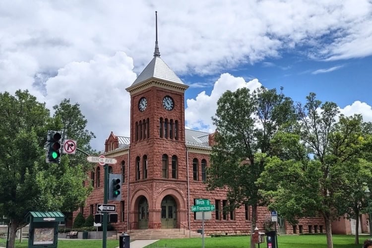
That afternoon, right on schedule, the clouds piled up over the peaks, and we headed downtown.
Before there was a town, Edward Beale’s survey crew camped at Leroux Springs, near the foot of the San Francisco Peaks, while laying out a wagon road to California in 1857.
The Army had sent along 25 camels to see how they would handle the desert. They handled it fine, hauling heavy loads over sharp rock without going lame. But the camel experiment didn’t survive the Civil War.
The name came later. The most popular story says that on July 4, 1876, a scouting party from Boston stripped the branches off a tall ponderosa pine at a spring used as a sheep camp. They raised the American flag on it to celebrate the nation’s centennial.
The railroad arrived in 1882, and the town grew up along the tracks on a steady diet of lumber, cattle and sheep. The tracks still run right through the middle of town.
The 1926 Santa Fe depot, a Tudor Revival building, now doubles as Flag’s visitor center, and Amtrak’s Southwest Chief stops daily. Up to 100 freight trains a day rumble past, horns blowing at every crossing.
Route 66 arrived the same year as the depot, and downtown looks the part, with red brick storefronts and old neon signs. The brick is no accident. Fires swept through early Flagstaff more than once, so in 1897, the town required all downtown buildings to be made of brick, stone, or iron.
We walked past the 1888 Babbitt Brothers Building, the town’s first two-story structure, built by David Babbitt, one of five brothers who came from Cincinnati to start a cattle company and a store.
Nearby are the Weatherford Hotel, which opened in 1900, and the Hotel Monte Vista, where John Wayne once stayed.
In Heritage Square, the public plaza at the heart of downtown, families spread out blankets for picnics and outdoor movies on summer weekends.
Flagstaff very nearly had a bigger claim to fame. In 1913, Cecil B. DeMille stepped off the train here, planning to shoot his first feature film.
By his own account, it was colder than New York and the scenery was wrong for the story, so he got back on the train and kept going to California. He set up shop in a barn in Hollywood instead.
“So Flagstaff could have been what Hollywood became,” Alex said.
Flagstaff Breweries: Pints on Route 66
With Northern Arizona University just south of the tracks, Flagstaff could pass for a college town, but it has plenty else going on, including more breweries than most towns this size.
Mother Road Brewing, in a 1920s building on an old stretch of Route 66, names its beers after the road, with labels like Daily Driver and Tower Station.
While Alex, not yet 21, dragged Nicole and Mom off to the shops, Rob, Nataliya, Dad and I ended up at Lumberyard Brewing Company, in one of the last buildings left from Flagstaff’s lumber days. The beer came in what was basically an aluminum can with the top cut off and sealed.
Dad turned his over and studied the bottom. “A can of beer you don’t even have to open.”
“Saves a step,” Rob said.
Sunset Crater: Fire On The Mountain
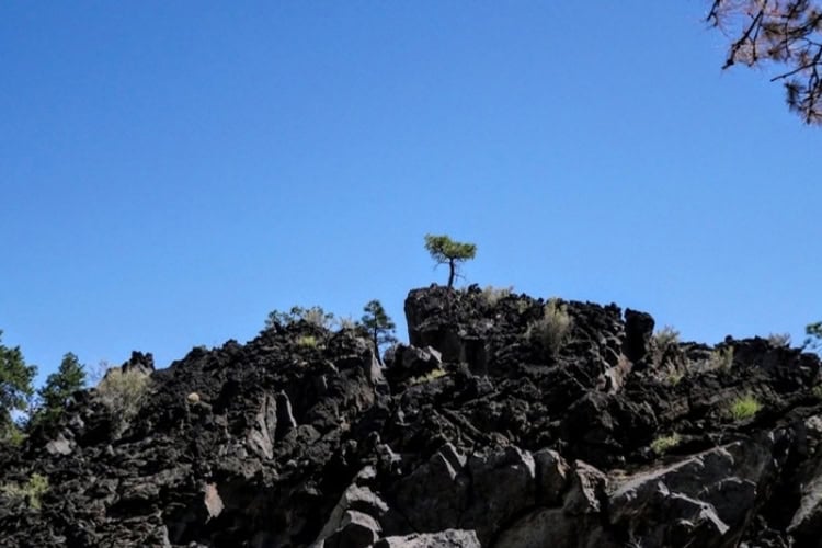
Fifteen miles northeast of town, just off U.S. 89, the pines give way to rocky black fields. Lava rock and cinders spread out on both sides of the road. Sunset Crater, a cinder cone more than 1,000 feet tall, its rim glowing red and gold in the sun, rises out of the middle.
Around 1085, the ground here split open. Earthquakes came first, then the ground split along a fissure nearly 6 miles long, and fountains of lava shot into the air, cooled into cinders, and piled up into the cone. Ash covered hundreds of square miles.
The Sinagua farmers who lived nearby took the earthquakes as a warning and got out of the way.
Explorer John Wesley Powell is credited with naming the volcano for the colors of its rim, which look like a sunset.
In the late 1920s, a movie company wanted to blow up part of the cone to film an avalanche. Harold Colton, who had just founded the Museum of Northern Arizona, rallied locals against the plan, wanting to preserve the natural beauty. In 1930, President Herbert Hoover made Sunset Crater a national monument.
Climbing the cone hasn’t been allowed since the 1970s, so we walked the Lava Flow Trail, a 1-mile loop along the Bonito Lava Flow at the foot of the cone. The lava there is broken into jagged black chunks that crunch underfoot, and ponderosa pines grow straight out of the cracks.
In 2022, the Tunnel Fire burned more than half the monument, and charred trunks still stand among the new growth along the road.
There are about 600 volcanoes in the San Francisco Volcanic Field, and Sunset Crater is the youngest.
“Is it inactive now?” Nicole asked.
“It’s inactive,” Dad said. “But the volcanic field could make a new one someday.”
“Probably not this week,” Rob assured us.
Wupatki: Home Court Advantage
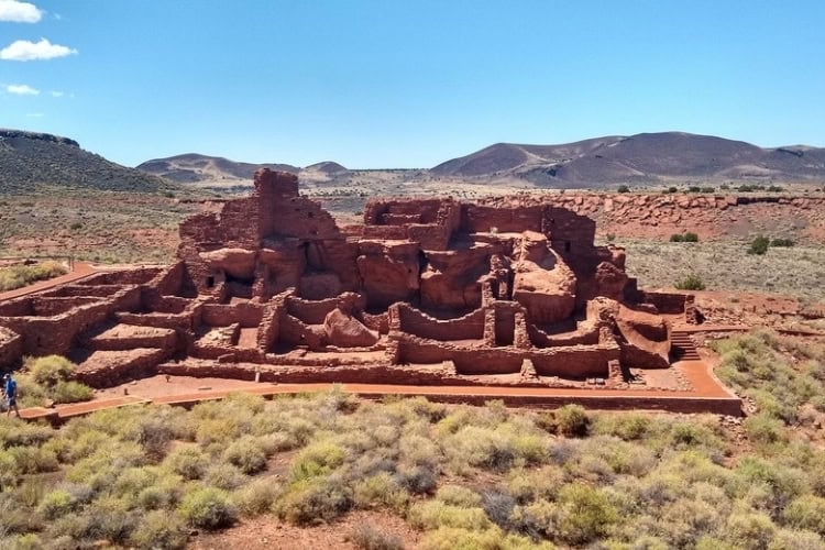
The loop road from Sunset Crater continues north to Wupatki National Monument. Along the way, the black cinders give way to red sandstone, and the views open up across the Painted Desert.
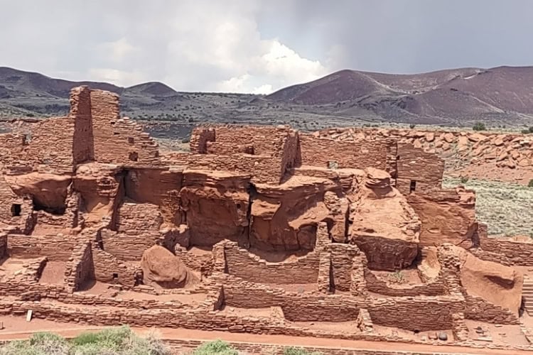
Wupatki is a Hopi name often translated as “tall house.” Wupatki Pueblo rises three stories from a sandstone outcrop, its walls built of thin red slabs fitted together like a puzzle. It had more than 100 rooms, and at its peak, around 1200, it was home to roughly 100 people.
The eruption drove people away, but within a few decades, farmers were moving in from several directions. A run of cooler, wetter years helped, and the ash may have worked as a mulch, holding moisture in the soil.
Archaeologists have found signs of Sinagua, Kayenta and Cohonina people living and trading here side by side.
A paved trail from the visitor center winds around the pueblo and past a large round community room, where people likely gathered for dances and ceremonies.
Below it is a walled ball court, the northernmost ever found. Courts like it usually turn up much farther south, in southern Arizona and Mexico.
Next to the court is a blowhole, an opening in the ground that connects to underground passages. Depending on the air pressure, it breathes in or out. That afternoon, it was blowing out a steady stream of cool air. Nataliya held her hand over it and laughed.
“Ancient air conditioning,” she said.
“Barometric,” Rob said.
By the mid-1200s, drought and a long tradition of migration had moved the people of Wupatki on to other communities. The Hopi, Zuni, and Navajo still have stories tied to this place.
On the way out, we stopped at Wukoki Pueblo, about 2.5 miles from the visitor center. The name means “big house” in Hopi, and its three-story tower rises from the top of a sandstone outcrop. From the road, it looks more like a small castle than a family home.
For more, read Explore the Epicenter of Navajo Culture at Canyon de Chelly.
Walnut Canyon: Cliff Notes
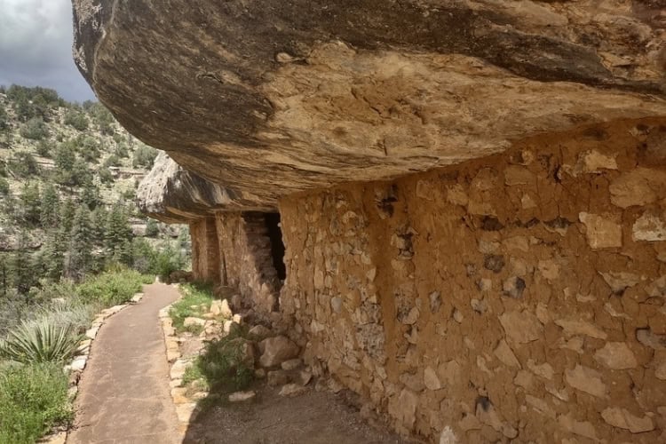
Walnut Canyon is only about 10 miles east of downtown Flagstaff, and you don’t see it until you’re standing on the rim. The canyon is about 400 feet deep and 20 miles long, named for the black walnut trees along the creek at the bottom.
Its walls are layers of pale limestone from an ancient seabed, dotted with pinyon and juniper. Erosion has carved them into long rows of ledges and overhangs.
Between about 1125 and 1250, the Sinagua built homes into those overhangs. The cliff dwellings sat mostly undisturbed until the railroad arrived in the late 1800s and brought souvenir hunters, who dug through the ruins for pottery, some of them armed with dynamite.
In 1915, President Woodrow Wilson made Walnut Canyon a national monument, and in the late 1930s, the Civilian Conservation Corps stabilized walls and built trails, including much of the Island Trail that visitors use today.
Inside the visitor center, a wall of windows looks straight out over the canyon.
The Island Trail drops 185 feet into the canyon on a paved path with plenty of stairs, then loops around a rocky peninsula past 25 cliff dwelling rooms. Going down is the easy part. The climb back out, at 6,700 feet, is another story.
The rooms are small and remarkably intact. Each one uses the overhang as a roof and the canyon wall as a back wall, with stone walls built across the front. Inside, the ceilings are still black from ancient cooking fires.
Mom, who had done the stairs on earlier visits, announced that once was enough and took the Rim Trail instead, a flat 0.7-mile path along the top with views down into the canyon.
“I don’t want you to walk it alone,” Dad said. He said to the rest of us, “We’ll wave.”
For more, read A Two-Day Itinerary for Mesa Verde’s Cliff Dwellings and Ancestral Pueblo Heritage.
Picture Canyon: Writing On The Wall
Picture Canyon is easier to miss. The 478-acre city preserve sits on the northeast edge of Flagstaff, where the Rio de Flag cuts a small basalt canyon on its way out of town.
The Northern Sinagua lived here between about 700 and 1300 and left hundreds of petroglyphs pecked into the dark rock: birds, turtles, archers, and geometric designs.
A short trail follows the creek to a waterfall in the narrowest part of the canyon, and the petroglyphs are scattered along the canyon walls nearby. Some are easy to spot. Others take a minute, until you see one and suddenly see a dozen.
“Look, geometry,” Nicole said, pointing to some geometric patterns.
“School’s out,” Nataliya said. During the academic year, she’s a math teacher. “I’m not grading those.”
Highway 180: Snowbowl and Red Mountain
U.S. Highway 180 runs northwest from Flagstaff toward the Grand Canyon, and most of the tourists on the road are headed there. We had two closer stops to make.
The first was Arizona Snowbowl, up a winding road on the slopes of the San Francisco Peaks, which are sacred to more than a dozen Native American tribes, including the Hopi and Navajo.
These days, it’s a seasonal ski resort. Being summertime, we just wanted to see the view. The ski runs were green and lined with aspen, and the scenic gondola was carrying people up to 11,500 feet, where the views stretch west across the forest toward Kendrick Peak and Bill Williams Mountain.
Back on Highway 180, the road passed through a stretch of forest that had burned not long before, black trunks standing in bright green new growth. About 25 miles from town, at milepost 247, a Forest Service sign pointed to Red Mountain.
Red Mountain is a cinder cone that erupted about 740,000 years ago. An amphitheater cuts deep into its northeast side. Geologists think steam explosions may have opened it soon after the eruption, and erosion has been widening it ever since, leaving red cliffs and hoodoos.
The hike in is short and easy, along a dry wash through pinyon and juniper. During our hike, the San Francisco Peaks were to our backs and Red Mountain’s bowl grew bigger before us.
We came to a ladder in the middle of the trail: a small wooden ladder, five or six rungs, propped against a 6-foot wall of red rock and silt, the remains of an old erosion-control dam. There was no sign explaining it.
At the top, we stepped into a red canyon open to the sky. Cliffs of volcanic cinder rose around us in bands of red and black, and hoodoos stood along the walls like sentries. The ground was soft red cinder that worked its way into everything, like soft sand.
Nataliya looked down at her white sneakers, now pink, and shrugged. She and I sat on a fallen tree trunk in the middle of the amphitheater while Nicole and Alex scrambled up the smooth slope for a better view.
Out Of This World
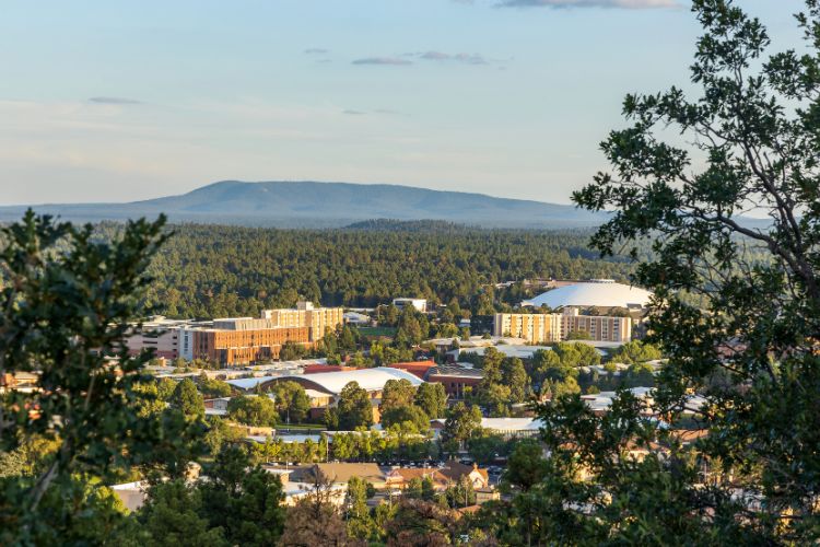
One reason Flagstaff guards its night sky from light pollution sits on Mars Hill, just west of downtown, where the white domes of Lowell Observatory rise through the pines.
Percival Lowell, a wealthy Bostonian, founded the observatory in 1894 to study what he was sure were canals on Mars. He was wrong about the canals. But in 1930, a 24-year-old astronomer named Clyde Tombaugh discovered Pluto here by comparing photographs taken with the observatory’s 13-inch telescope.
Our tour of the observatory started with the 24-inch Clark Telescope, which Lowell built in 1896 to study Mars. In the 1960s, it helped map the Moon for the Apollo missions.
The telescope still works, and on public nights it’s pointed at the sky. Lowell himself is buried a short walk away, in a mausoleum on Mars Hill. We also passed the dome that houses the telescope used to find Pluto.
In 2006, the International Astronomical Union reclassified Pluto as a dwarf planet. Arizona answered in 2024 by making Pluto its official state planet, so as far as Flagstaff is concerned, the matter is settled.
After dark, the roof of the observatory’s open-air viewing deck rolled back, and the staff aimed a telescope at Saturn. Nicole looked first, then stepped back and looked at me.
“Wow,” she said. “You can see the rings and everything!”
Meteor Crater: Deep Impact
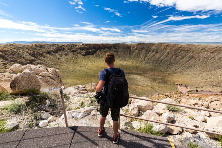
The next day, we traded gazing at the sky for visiting something that had fallen out of it. Meteor Crater is about 40 miles east of Flagstaff on Interstate 40.
Roughly 50,000 years ago, a meteorite traveling more than 25,000 mph slammed into the desert here and left a hole about three-quarters of a mile across and 560 feet deep. It’s considered the best-preserved meteorite impact crater on Earth.
“Deep impact,” Alex said, remembering a film of the same name.
Mining engineer Daniel Barringer spent 27 years drilling here, convinced that a giant chunk of iron lay buried under the crater floor. It didn’t. Most of the meteorite had vaporized on impact. His family still owns the crater.
NASA sent Apollo astronauts to Meteor Crater to train, one stop on a long list around Flagstaff. The U.S. Geological Survey moved its astrogeology program to town in the early 1960s, and every astronaut who walked on the moon trained in the area.
In 1967, USGS geologists even built a practice moon in the cinder fields just south of Sunset Crater, packing holes with explosives and blasting 143 craters laid out to match part of the Apollo 11 landing site. Two years later, Neil Armstrong landed about 4 miles from the spot the geologists had copied.
Museum Of Northern Arizona
The Museum of Northern Arizona sits at the foot of the San Francisco Peaks, a few miles north of downtown, on a 200-acre campus shaded by pines. Harold and Mary-Russell Colton founded it in 1928 to preserve the region’s Native cultures and natural history. Its main building is made of local stone.
Inside, one gallery tells the stories of 10 tribes of the Colorado Plateau, with objects chosen with the help of tribal members. The museum also holds an extensive collection of Hopi katsina dolls and Native pottery.
On this visit, Nicole lingered longest at a full-size skeleton model of Dilophosaurus, a meat-eating dinosaur that once roamed northern Arizona.
Northern Arizona University: Higher Education
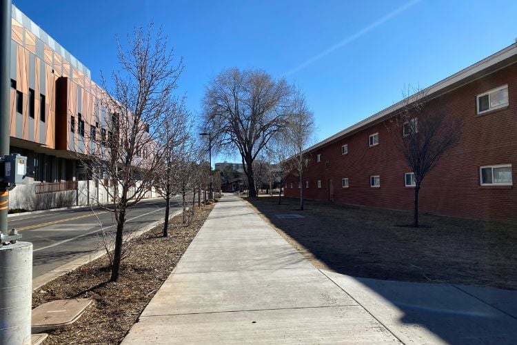
Northern Arizona University starts just south of downtown, on a campus shaded by tall ponderosas. Its oldest building, Old Main, is a heavy block of red Moenkopi sandstone that went up in the 1890s as a reform school for what the territory called its “vicious youth.”
Plans changed before any troublemakers arrived, and in 1899, the building opened as Northern Arizona Normal School, a school for training teachers. Its first four graduates in 1901 were all women. It became Northern Arizona University in 1966.
Today, Old Main houses the NAU Art Museum, which is small and easy to miss, but worth finding. Its permanent collection features more than 1,000 works, including a study collection of Asian art with pieces thousands of years old. It has shown works by Diego Rivera and R.C. Gorman. The galleries rotate several exhibitions a year.
Next to campus, Riordan Mansion State Historic Park preserves a 1904 Arts and Crafts home built for Timothy and Michael Riordan, brothers who made their fortune in Flagstaff’s lumber business.
Designed by Charles Whittlesey, the architect of the El Tovar Hotel at the Grand Canyon, it’s actually two houses joined by a shared billiard room.
The End Of The World As We Know It
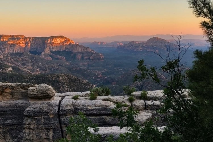
A good trip to Flagstaff should include at least one night under the stars, lit by campfire. We opted for the End of the World.
Forest Service maps call it East Pocket. Locals call it the Edge of the World or the End of the World.
To get there, we drove west on Route 66, turned south on Woody Mountain Road and followed it about 23 miles into the forest, most of it on dirt.
The road is rutted and washboarded, and snow can make it impassable in winter. Even in summer, the vibration of the road makes it seem almost impassable.
There’s no campground, just dispersed camping on national forest land. We pitched our tents near the rim, not far from a 1943 wooden fire lookout and Jenga Rock, a stack of boulders that looks one good breeze away from collapsing.
Nataliya does not like camping. She agreed to this trip on one condition: The view had to be worth it.
We built a fire and sat around it eating packed sandwiches and chips and fruit and watching the sun go down and the red rock below turn orange, then purple. Across the valley, the lights of Jerome came on along the side of the Black Hills.
Nicole pointed to a cluster of lights between red mountains to the south and asked what it was.
“Sedona,” Rob told her. “We’ll be down there tomorrow.”
Sitting around the campfire in a semicircle, looking out across the valley below, we talked, listened to music, and drank local craft beer and soda from the cooler. Later, with the fire down to coals, the stars came out by the thousands.
Nataliya pulled her jacket tighter and looked out over the valley. “The view is worth it,” she admitted.
Sedona: Seeing Red
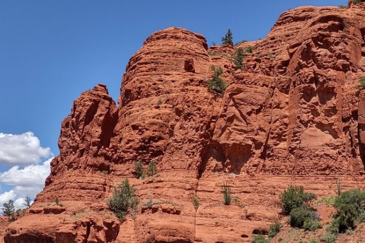
In the morning, we packed up, rattled back out to the pavement, and took state Route 89A south toward Sedona, less than an hour from Flagstaff. At Oak Creek Vista, at the top of the canyon, Native artists sell jewelry from tables along the overlook. From there, the road drops through a series of tight switchbacks and follows Oak Creek through a lush canyon, with sycamores and cottonwoods shading the water and red cliffs rising on both sides. We passed Slide Rock State Park, where a natural water slide in the creek bed draws crowds all summer.
Mom and Dad reminisced about a camping trip they took to Slide Rock back in the late 1960s. Not much has changed in the natural habitat since then. Except, perhaps, the crowds.
First, we went a few miles southwest of town to Red Rock State Park, 286 acres along Oak Creek with about 5 miles of trails. We hiked the Eagle’s Nest Loop to the park’s highest point, with Cathedral Rock in view most of the way, its spires a deep red against an impossibly blue sky. Down at the creek, a great blue heron stood on a rock in the water, fishing for breakfast.
Uptown Sedona: Vortexes and UFOs
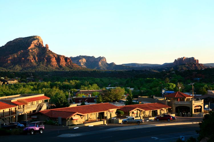
Uptown Sedona is where the scenery meets the sales floor. Galleries, jewelry stores, and souvenir shops line state Route 89A, with the red cliffs hanging overhead. The shops sell everything from soaps and candles to taxidermy squirrels and Native American artwork.
A short drive south, the Chapel of the Holy Cross lets the rocks do the preaching. The Roman Catholic chapel, finished in 1956, was built into the red rock buttes, with a 90-foot cross as its centerpiece.
For a quieter stop, the Amitabha Stupa and Peace Park sits at the base of Thunder Mountain, where a 36-foot stupa and a large wooden Buddha statue look out over town.
There’s more to Sedona than meets the eye. Psychic Page Bryant began calling certain red rock spots “vortexes” around 1980, and the town has been selling the idea ever since. The Forest Service says it can’t back the energy claims scientifically, but jeep tours still run out to the vortex sites, shops along 89A advertise aura photos and psychic readings, and after dark, UFO tours hand out night-vision goggles. At least one company guarantees a sighting or your money back, making one wonder how they stay in business. Skeptics can still enjoy the scenery, which, unlike the aura photos, requires no interpretation.
We climbed back up Oak Creek Canyon in the late afternoon, and the dashboard thermometer began to fall the way it had on the drive up from Phoenix. Sedona has the red rocks, but Flagstaff has the altitude. By dinner, we were back on the deck, about 2,500 feet higher and cooler, just as promised.
The Long Way Home
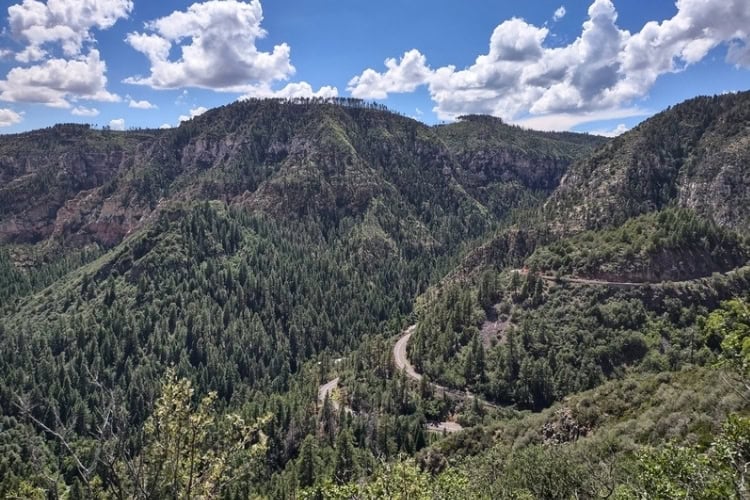
We took the long way back to Phoenix’s airport. Instead of heading straight down I-17, we followed 89A back through Oak Creek Canyon and across the Verde Valley, then up the side of Cleopatra Hill to Jerome, an old copper-mining town.
At its peak in the early 1920s, Jerome was home to an estimated 10,000 to 15,000 people. After the mines shut down in 1953, the population plunged, and the town earned its reputation as a ghost town.
Today fewer than 500 people live there, in old buildings stacked up the steep hillside alongside art galleries, cafes, and saloons. The old jail has slid about 200 feet downhill since the ground beneath it began giving way in the 1930s.
Past Jerome, the road wound over Mingus Mountain toward Prescott, and from there it was downhill all the way. Not long after we merged back onto I-17, the saguaros were back with their arms up, and the dashboard read 109.
“I can still smell the pines,” Nataliya said.
We’ve been coming to Flagstaff for about 10 years now, and every visit turns up a trail or a view we hadn’t found before. Some sites are fresh and new, and others feel like familiar friends. It has started to feel a lot like a home away from home.
Rob makes sure we keep coming back. That morning in the driveway, he was already talking about our next visit. “Next time, we’ll tackle Humphreys.”
“Yes,” I agreed. “We’ll have to find time for it next time.” And I actually meant it.
If You Go
We stay with family, which is the best lodging deal in Flagstaff and comes with a personal tour guide. Everyone else has plenty of options, from dispersed camping in Coconino National Forest to motels along Route 66 and full-service hotels. For history and atmosphere, the Weatherford Hotel and the Hotel Monte Vista are right downtown. Book early for summer weekends, because many Phoenicians head north to escape the heat.
Flagstaff Pulliam Airport is small, with just a few nonstop routes. Most visitors fly into Phoenix Sky Harbor International Airport, about 2 hours south, or Las Vegas, about 4 hours away. Either way, rent a car. Some of the best sites, including Red Mountain and the End of the World, sit at the end of dirt roads.
One entrance pass covers both Sunset Crater Volcano and Wupatki National Monuments; Walnut Canyon requires its own, and an annual pass covers all three. America the Beautiful passes are accepted and can be bought online ahead of time. Lowell Observatory sells its own tickets.
Whatever the season, pack a light jacket. At 7,000 feet, nights can be cool even when Phoenix is blazing.
Need a hand planning your trip? Here are the sites and services we rely on most, from booking tools to travel products we love.
Inspire your next adventure with our articles below:
- How to See the Iconic Horseshoe Bend in Arizona by Land and by Water
- Art, Flowers, Food and Stars: Mesa, Arizona, Offers More Than Spring Training Baseball
Author Bio: Eric D. Goodman is the author of seven books and more than 100 published short stories and travel stories. His most recent is Faraway Tables, a collection of travel-centric poetry. Learn more about Eric’s travels and his writing at www.EricDGoodman.com.
Want to discover more hidden gems and helpful travel tips? Join our free newsletter for the latest travel secrets and travel articles.
We are reader-supported and may earn a commission on purchases made through links in this article.

- Flagstaff, Arizona: Cool Mountain Air, Dark Skies and Red Rock Day Trips - November 4, 2026
- Montenegro’s Bay of Kotor: Stone Towns, Venetian Walls and Mirror-Calm Water - October 11, 2026
- Rila Monastery: A Day Trip Into Bulgaria’s Spiritual Heart - September 23, 2026
Planning another trip soon? ✈️
Add GoWorldTravel.com as a preferred source on Google. Click the button below so our local guides, packing hacks, and hidden-gem itineraries always show up first when you search!
Add to Preferred Sources