Go World Travel is reader-supported and may earn a commission from purchases made through links in this piece.
The lore of Southern Colorado was omnipresent as I drove the Highway of Legends Scenic and Historic Byway. Time was on my side, which was one of the reasons I opted to take this detour.
That and the fact that I’m typically attracted to the road less traveled, especially when there’s a colorful history attached to it, not to mention an impressive landscape…and pie.
You can start the route from either Walsenburg or Trinidad and go south or north respectively. The total distance is about 80 miles, so plan about two hours for the trip – more if you stop along the way. I began the journey in Walsenburg.
Starting in Old West Walsenburg
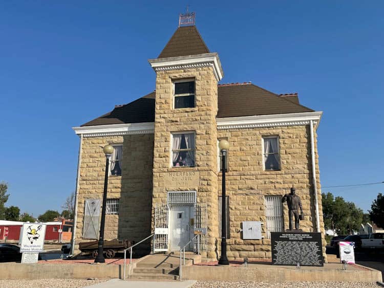
Walsenburg is an Old West town with historic buildings lining Main Street. You’ll find eclectic shops, antique stores and cafes, as well as a few museums.
The Walsenburg Mining Museum, for example, is located in what used to be the county jail, circa 1896. Inside are artifacts, photo, mining tools and assorted memorabilia that tell the story of the “city built on coal.”
There’s also the Museum of Friends, a compilation of hundreds of artworks donated by contemporary artists. Head out of Walsenburg and get on Colorado Highway 12, a two-lane road with views of volcanic formations and the iconic Spanish Peaks.
Get a guidebook or download an audio tour of the Highway of Legends if you want to know what to look for as you drive through some of the state’s most scenic National Forests, State Parks, Wildlife Areas and mountain ranges. Such tools help enhance your experience by providing background information about the land, people and lore of this region.
First Stop on the Highway of Legends
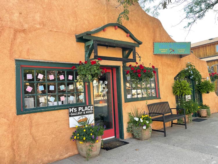
La Veta is the first town you’ll come to from this direction on the Highway of Legends. Stroll down the streets and take a peek into the different art galleries, as this is an art hub. It’s also the home of the Francisco Fort Museum.
The fort was established in 1862 by Colonel John Francisco for trading and protection purposes. A year later, the Utes placed it under siege. Francisco was eventually able to negotiate a deal with the tribe’s chief, whereby the chief would get several head of the fort’s cattle in return for leaving the fort alone.

The fort is the last surviving, original adobe fort in Colorado and is now a museum, with Native American, pioneer and Spanish settler artifacts. Step back in time as you tour the place, along with its historic outbuildings, including an 1890s saloon, log schoolhouse, blacksmith forge and more.
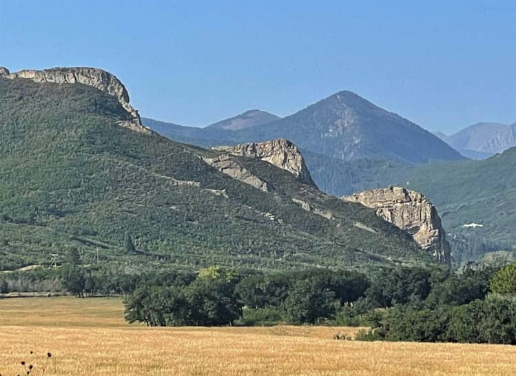
If you have a good eye, you might be able to make out the profiles of George Washington and Thomas Jefferson on Profile Rock, about five miles from La Veta. I had to really look.
This rock formation is one of the many dikes that rise out in spoke-like fashion from the Spanish Peaks. There are over 400 of these unique geological formations in the region, created during the time of the volcanos.
Legends of Profile Rock & The Devil’s Stairsteps
Native Americans have a legend regarding Profile Rock, and it concerns a band of giants that once roamed the area. They fought amongst themselves in an aggressive fashion, using huge boulders as weapons.
The gods were angered by these battles and decided to withhold rain as punishment. Forced to end their conflicts due to lack of water, the giants departed, leaving one warrior to guard the valley.
The giants never returned, but the guard continued to remain as the lone sentinel. One day, he sat down to rest and the gods, who noted his depth of commitment, turned him into a stone monument.
The Devil’s Stairsteps is also a dike and one of the most notable in the Spanish Peaks. Of course, there’s a tale associated with this formation, and this one’s about the Devil. When the earth was new, the Devil was able to leave his home to look at the world.
He surveyed it from the Cuchara Valley, climbing rock steps to sit on the mountains. There he plotted to seize everything for his own. God heard of the Devil’s intentions for this dramatic landscape and banished him from ever visiting earth again. His stairs, however, remain.
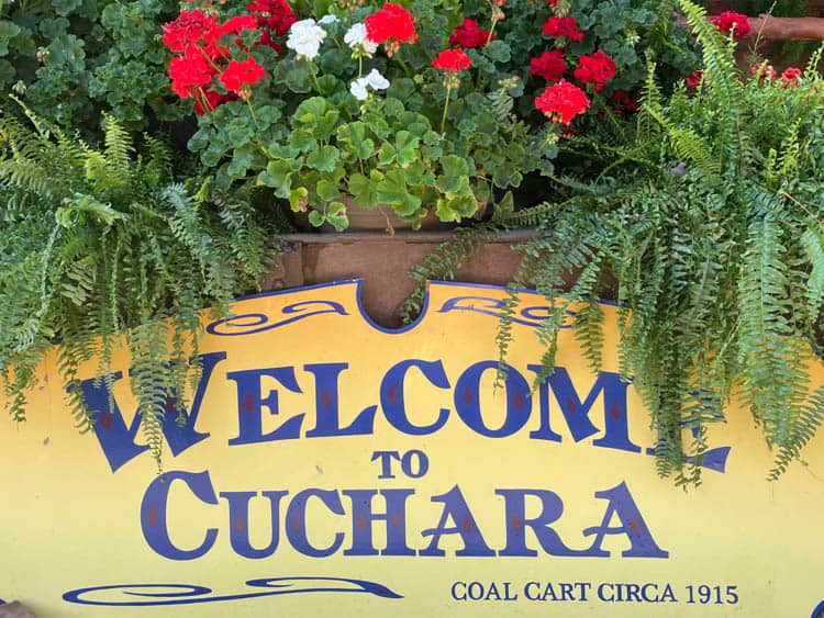
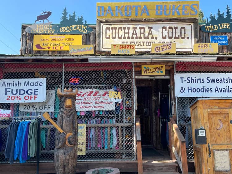
Visit Dakota Dukes in Cuchura
Further down the Highway of Legends, the Dakota Wall emerges. Nicknamed the “Backbone of the Rockies,” this geological formation dates back millions of years ago, when sand, which had settled at the bottom of a lake, became rock.
The rock was subsequently pushed vertical. Actions by the Cucharas River then created a gap in the rock wall.
In Cuchara, I roamed the tiny main street and peered inside a few of the shops, including Dakota Dukes, a store that seemed to sell everything under the sun. The place was chockful of merchandise, from fishing supplies and assorted sundries to arts and crafts items, t-shirts, fudge and souvenirs galore.
Outside, I couldn’t resist the temptation to put fifty cents in the slot to see Sourdough Sam. When the door opened, it revealed a figure of a comical old-timer, perched on an outhouse throne in his long, red underwear, which was draped around his ankles!
Cuchara, I learned, is Spanish for “spoon.” The valley has a spoon shape so the name makes logical sense. How it got this shape has to do with those notorious giants once again. One supposedly left his spoon on the side of the mountain in a downpour, resulting in an impression in the side of the peak.
I also discovered a tiny satellite library room of all things in the middle of this charming hamlet. There I met Peggy, the librarian. We had a delightful conversation about the town, but my ears immediately perked up when she mentioned the word “pie.”
I learned that further up the highway in Stonewall was a café with some of the best homemade pies in the area. And I was off.
As you ascend Cuchara Pass (9,994 feet), the mountains take on meaning when you learn that the Tarahumare Indians held them to be sacred and believed that all life stemmed from this place. It is said they would gather at the top of the pass each month to exchange tales of their bravery.
Each made up a dance for his display. The warrior with the best dance of the most courageous deed would receive a feather to wear. As he circled the fire with his feather, he rose to the top of the trees.
Ultimately, he would be turned in a spruce tree. Over the years, a forest of spruce trees formed in the spot.
Lake of Tears
North Lake is a State Wildlife area, home to a variety of animal and bird species, not to mention four types of trout. The local lore focuses on a man named Tom Tobin, who was known for his tracking skills, and lived in a cabin above the lake.
Tobin’s claim to fame is that he led troopers to two notorious outlaws, who had killed 32 people. After the pair were shot and killed, Tobin cut off their heads and put them in a sack as proof for the monetary reward.
Governor Evans, who was governor of Colorado at the time, bought Tobin a buckskin suit as thanks. But Tobin never did get the money he deserved. They say that from that point on, Tobin slept with a gun, as he feared the relatives of the outlaws would come after him.
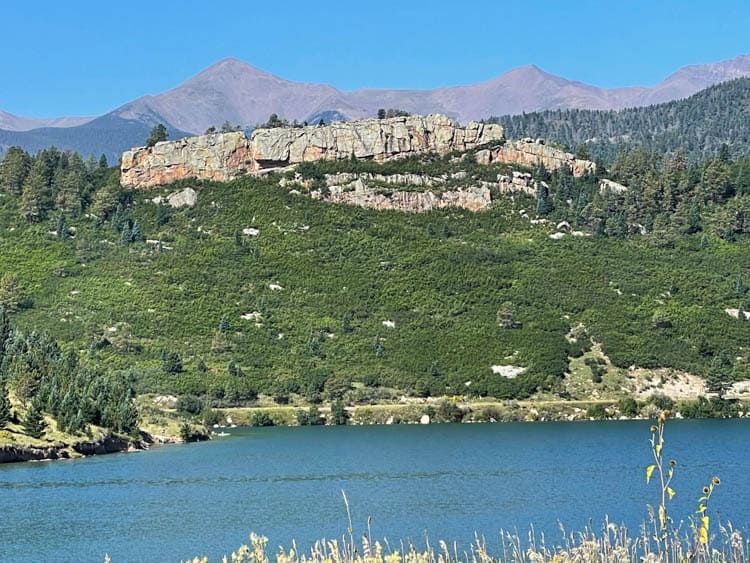
I stopped at picture-pretty Monument Lake for a peaceful rest bit. There used to be a rock formation rising above the water in the center of the lake, but it collapsed.
The story has it that two Indian chiefs, unknown to one another, traveled from their respective homes in search of water, as this precious commodity had disappeared from the mountains due to volcano action. When the men met, they hugged in friendship, but upon realizing that neither had found water, they started crying. Their tears created a lake at their feet.
However, a volcano seized the moment to erupt, covering the men in lava and turning them to stone, hence, the monument. It is said their tears made the volcano cease and brought back water for the people.
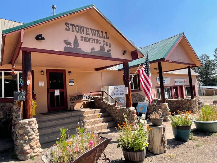
Stop in Stonewall for Perfect Pie
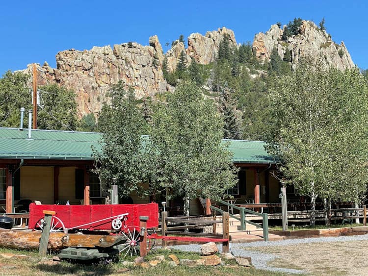
The first thing you’ll see as you drive into Stonewall is a massive rock wall that rises 250 feet. It’s part of the formidable Dakota Sandstone Formation. I admired the geology, then honed in on the Stonewall Shopping Bag, part general store, part café. And yes, here’s where I found pie.
At the Shopping Bag, pies are baked fresh each day, with an assortment that includes everything from cherry, peach and raspberry rhubarb to apple crumble and coconut cream. I opted for raspberry rhubarb; my husband decided on coconut cream.
As a gal who loves pie, but is super picky about the crust, I was skeptical about this pie until I dug in and tasted a delicious balance of sweet and tart filling with one of the flakiest pie crusts I’ve eaten. As I swooned, my husband waxed rhapsodically over his coconut cream.
You must take a short detour to see what’s left of the “House on a Bridge” in Vigil. Colorado State Senator Joseph Martinez built the original structure in 1918, which was later replaced by the current dwelling.
More interesting to learn at this juncture, though, is the wedding traditions of the time. The guidebook explains that parents arranged the marriages of their kids via letters, as young people had no say over their future spouses.
The groom’s parents then bought the wedding dress for the bride and often she didn’t see the gown until the day of her nuptials.
One time, a young man, who had been courting two girls simultaneously, finally made his decision. He subsequently requested the mother of the unchosen girl to be a cook at his wedding.
She agreed and then proceeded to find a special herb to grind into a fine powder. At the wedding, she sprinkled some of it in the groom’s food. The result – a sick groom, who had to leave the celebration prematurely.
Blood & Coke on The Highway of Legends
Near Weston, you can see the Sangre de Cristo Mountains, which got their name from the early Spanish explorers. The men noted that the peaks glowed red at sunrise and called them “Sangre de Cristo” which translates to “Blood of Christ.”
In these mountains is a gold mine. Purportedly, an old prospector found a hefty nugget up there that supported him for a year. As time went on, he would come back to town on an annual basis, each trip carrying another nugget to purchase all his supplies.
He told someone he was able to find the mine, using the morning’s reddish tint on the snow as his guide. After he died, people searched for this motherlode, to no avail.
At Segundo, the stories focus on mining and coking camps. This place used to be the largest coal processing plant west of Chicago, boasting 800 coke ovens. Mr. Chrysler of the automobile dynasty once lived in the area and is said to have built his first car here.
Another fun story regales the hijinks of some of the students in the area who had to take the train to high school each day. Occasionally, the boys would roll boulders onto the tracks at night to cause the train to be delayed the next day.
One time, John D. Rockefeller, owner of the company that operated the train, was aboard. After that, the students were never late to school again.
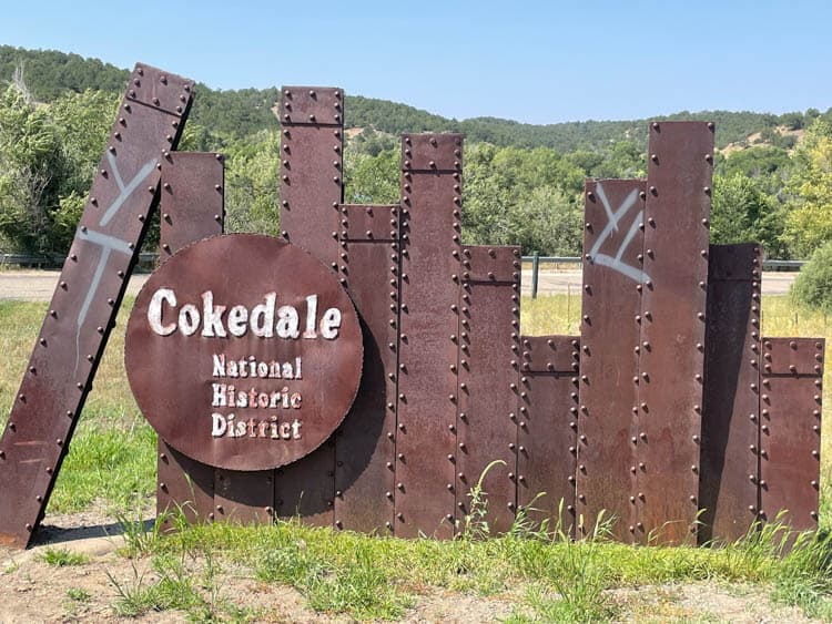
At Cokedale, remains of the coke ovens built at the mining camp of Cokedale in 1907 are on display. It’s a reminder of the coal industry when coke was the dominant fuel. After the mines closed in the mid-1940s, residents organized and Cokedale was incorporated. The original town still stands and is on the National Historic Register.
Coal Miners and Conquistadors in Trinidad
Before reaching Trinidad, the southern terminus of the route, you’ll get a good view of Trinidad Lake, which is part of Trinidad Lake State Park. About 2,300 acres of park surround the 900-acre body of water, which was created upon construction of a dam on the Purgatoire River back in the late 1970s.
The river got its moniker many years ago after Spanish conquistadors came to explore the area, looking for one of the rumored cities of gold. When they didn’t find it, the two leaders of the expedition argued and fought.
One died and the other took the helm, continuing on the search. But the group was never seen alive again. Only their bones and armor were found along the river bank. Because they died without the rites administered by a priest, they were said to be in Purgatory.
In Trinidad, the southern terminus of the Highway of Legends, head to the city’s historic downtown. Tour the Trinidad History Museum, which recounts the city’s past from the mid-1850s to the early-1930s.
It includes historic homes and gardens, along with a museum devoted to the Santa Fe Trail. And if you’re into cowboy-themed paintings, put the A.R. Mitchell Museum of Western Art on your list. The tin ceilings and horseshoe-shaped mezzanine are a nice touch.
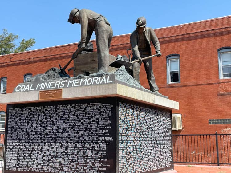
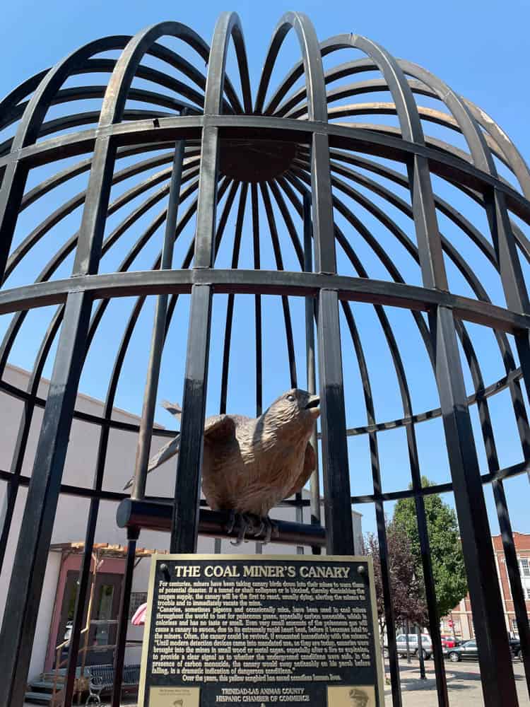
There’s also the Coal Miners Memorial Museum, for all things coal in the region. A tribute to Southern Colorado coal miners, active and deceased, stands in a plaza in the middle of town. And nearby is a statue of a large cage with a canary inside.
Locals had it erected to pay tribute to these birds, as they were once used to alert coal miners of possible danger in the mines.
Book This Trip
Ready to hit the road in Southern Colorado? Get some help planning your adventure with hotel options along your route through Booking.com. You can also find VRBO accommodations, local restaurant reviews, scenic highway stops and more through TripAdvisor and Travelocity.
Make the most of your open-road Colorado journey by renting an RV through RVShare. If you are looking for the best seasonal promotions on flights to Colorado, then check out CheapOair.
Author Bio: Debbie Stone is an established travel writer and columnist, who crosses the globe in search of unique destinations and experiences to share with her readers and listeners. She’s an avid explorer who welcomes new opportunities to increase awareness and enthusiasm for places, culture, food, history, nature, outdoor adventure, wellness and more. Her travels have taken her to nearly 100 countries spanning all seven continents, and her stories appear in numerous print and digital publications.