
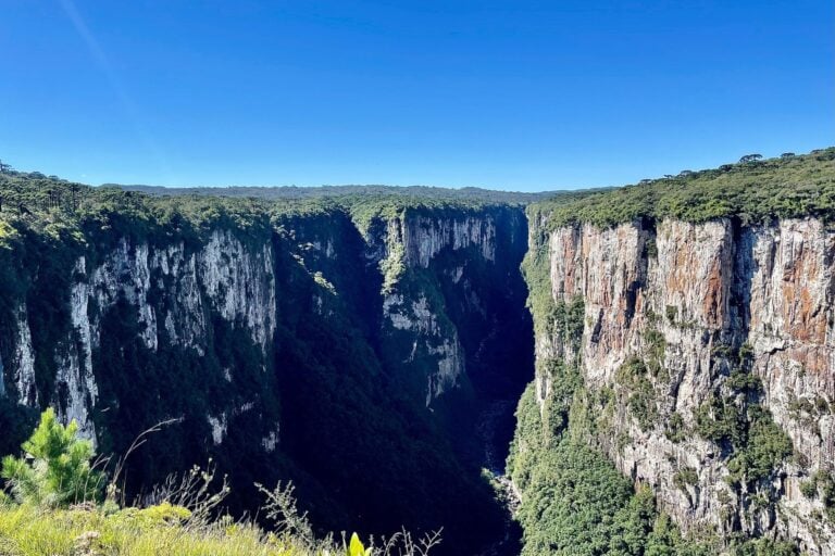
When our friends insisted we had to visit the canyons of Cambará do Sul while living in Rio Grande do Sul, Brazil, I didn’t really get the hype.
I understood it even less as I drove towards the region late at night with my fiancé, in pitch darkness, driving abroad for the first time and tackling unpaved gravel roads. Dust kicked up behind our little rental car as we pushed on, with no idea what might be around the next bend.
In hindsight, travelling during daylight would have been wiser.
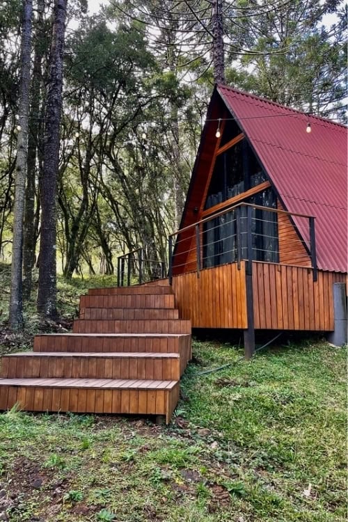
We wouldn’t see the canyons until the following morning. That first night, we headed deep into the forest, navigating with little phone signal and few road signs, until we finally found our small A-frame cabin among the trees.
The cold was the first surprise. At around 1,000 metres above sea level, Cambará do Sul is known as one of the coldest places in Brazil. I watched my breath fog in the misty evening air before stepping inside and lighting the wood-burning stove.
Land Of Canyons
Cambará do Sul is a municipality of just over 6,000 people in Brazil’s southernmost state, Rio Grande do Sul. Locally, it is known as Terra dos Cânions (the Land of Canyons), and its best-known canyon landscapes lie within two national parks.
We had come to see its two most famous canyons: Itaimbezinho, in Aparados da Serra National Park, and Fortaleza, in the neighbouring Serra Geral National Park. Our cabin just outside town gave us a base between the two, surrounded by Atlantic Forest, araucaria trees and the sort of darkness that makes the Milky Way startlingly clear.
A multi-day ticket gave us access to both parks, so we planned one canyon for each full day.
Itaimbezinho Canyon
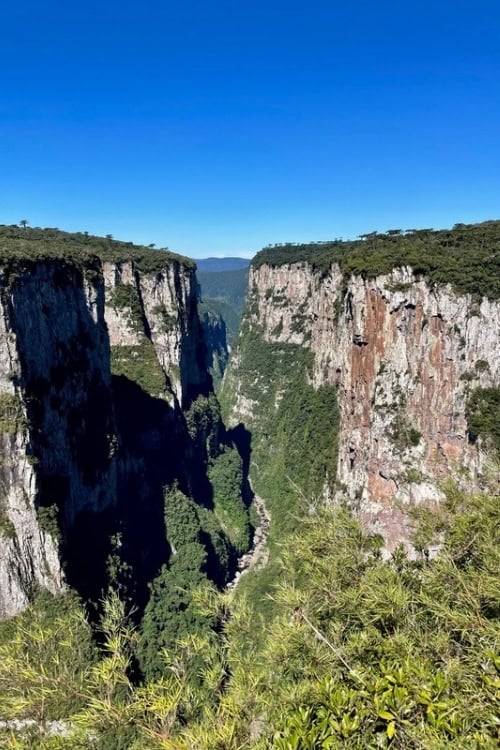
The following morning, we drove to Itaimbezinho Canyon, whose name translates from the Indigenous Tupi-Guarani language as “sharp stone.”
What surprised me most was how hidden it felt. I had expected the canyon to announce itself long before we reached it, but even after parking, there was little sense of the vast drop nearby.
We followed Trilha do Cotovelo, an easy, mostly level walk we covered in about 60 minutes each way. For much of it, the path felt more like the southern English countryside than the dramatic landscape I knew lay ahead, with brambles and trees forming a natural arch over the trail.
Then the vegetation opened.
The canyon walls dropped as much as 720 metres below us, while a pair of cliff flycatchers flitted across the void before settling on the rock face. Wooden viewing platforms marked parts of the edge, but they did little to lessen the feeling of the earth opening beneath us.
Beyond Itaimbezinho, rolling hills and smaller folds in the landscape seemed to stretch endlessly into the distance. Only a handful of other visitors were walking the trail that morning, and for long stretches we had the viewpoints to ourselves.
By early evening, we were back at the cabin resting our legs. Completely isolated in the woods, we soaked in the hot tub while small birds moved between the trees, then cooked dinner as the temperature dropped outside and the wood stove warmed the cabin. Once darkness settled properly, the sky was clear enough to see the Milky Way above the forest.
Fortaleza Canyon
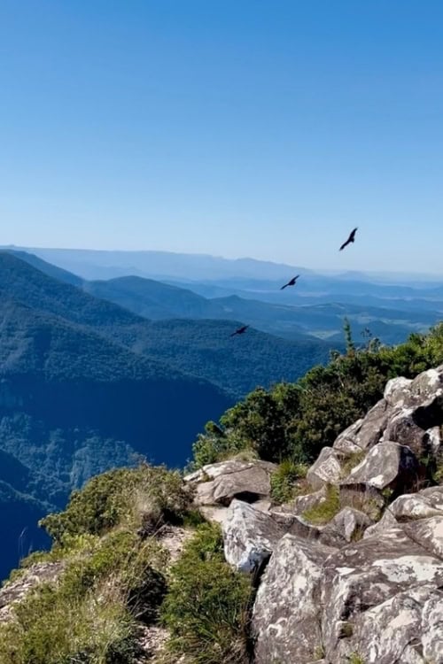
Photo by Ellen Carter
The next morning, we drove to Fortaleza Canyon in Serra Geral National Park.
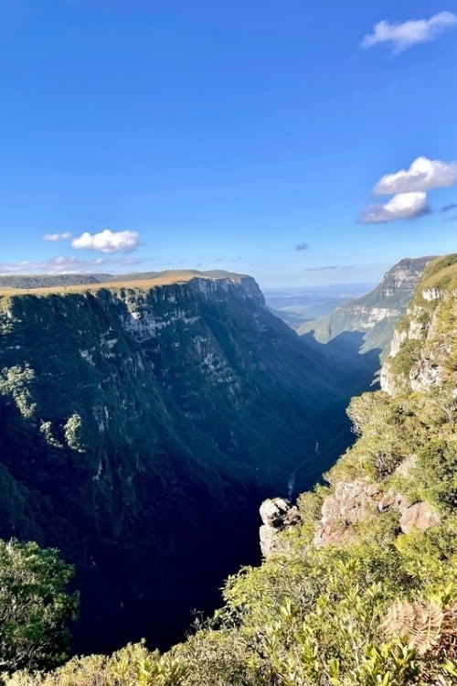
If Itaimbezinho had felt hidden and enclosed, Fortaleza was the opposite: open, exposed and enormous. The canyon stretches roughly 7.5 km, with some walls reaching around 900 metres, and on a clear day the views extend all the way towards the coast.
We ambitiously set out to tackle the main trails. The terrain was rougher and steeper than the previous day, but the approaches were also more dramatic, crossing rocky streams, small waterfalls and wide stretches of grassland before reaching the canyon itself.
Everything here seemed bigger. Even the birds were bigger.
We spent an age watching black vultures circle over the vast cavity in twos and threes, riding the air currents above the canyon. Elsewhere, smaller birds including small-headed elaenias darted through the grassland, while butterflies and dragonflies moved around the streams.
Fortaleza also felt less restricted. In some sections, simple wire barriers were the only thing separating the trail from the exposed cliff edge, and getting close enough to look down was enough to make my stomach turn.
For me, the trails were more interesting than those at Itaimbezinho. There was more variety underfoot, more wildlife, and a stronger sense of the landscape opening out around us as we walked.
Despite receiving only two pages in my 655-page Brazil guidebook, Cambará do Sul ended up being one of the places that has stayed with me. Two pages hadn’t come close to preparing me for the scale of the place.
Our friends had been right about the hype.
If You Go
Getting There: Cambará do Sul is around a three-hour drive from Porto Alegre. A bus service exists, but driving is by far the easiest option, especially if you plan to visit both national parks.
Getting Around: Unless you book with a local tour company, a car is the most practical way to reach both Itaimbezinho and Fortaleza. The roads can be rough and unpaved, so allow extra time.
Parks and Trails: Access, ticketing and trail conditions can change, particularly after heavy rain, so check current park information before travelling. We bought a multi-day ticket that covered both national parks.
What to Bring: Weather can shift quickly in the highlands. Bring layers, water, sunscreen, rain protection, and good walking shoes. We had little to no phone reception around parts of the parks and near our cabin, so downloading maps in advance was useful.
Where to Stay: Cambará do Sul has traditional hotels and pousadas, but cabins, cabanas and eco-lodges are particularly common. We stayed in an A-frame cabin just outside town, which made an atmospheric base for the weekend.
Inspire your next adventure with our articles below:
- A Weekend in Gramado, Brazil’s Alpine Getaway
- A Stay at Estancia Cerro Guido Will Enrich Your Patagonia Experience
Author Bio: Ellen is a British travel writer currently based in Porto Alegre, Brazil.
Want to discover more hidden gems and helpful travel tips? Join our free newsletter for the latest travel secrets and travel articles.
We are reader-supported and may earn a commission on purchases made through links in this article.

- A Weekend in Cambará do Sul: Hiking Brazil’s Itaimbezinho and Fortaleza Canyons - October 12, 2026
- Asturias, Spain: Fishing Villages and Wild Beaches on the Green Coast - October 12, 2026
- Darwin, Australia’s Northernmost Capital, Combines Vibrant Markets, Waterfront Life and Access to Kakadu and Litchfield - October 11, 2026
Planning another trip soon? ✈️
Add GoWorldTravel.com as a preferred source on Google. Click the button below so our local guides, packing hacks, and hidden-gem itineraries always show up first when you search!
Add to Preferred Sources