Go World Travel is reader-supported and may earn a commission from purchases made through links in this piece.
In April, I moved from Germany to Anaheim, California. After leaving my entire life behind, I felt like I needed a new task. Something that keeps me busy and outdoors as much as possible.
Since I also decided to work out more frequently to compensate the calories of the amazing and “healthy” American food, I came up with the idea of starting to check out nature reserves and national parks in close proximity to my new home by foot.
Especially those that are not much advertised to tourists yet. This way, I could stay active and discover the beauty of nature right in front of my doorstep. And boy did I make a good discovery with the first place I randomly picked: Aliso and Wood Canyons Wilderness Park, a coastal canyon close to Laguna Beach.
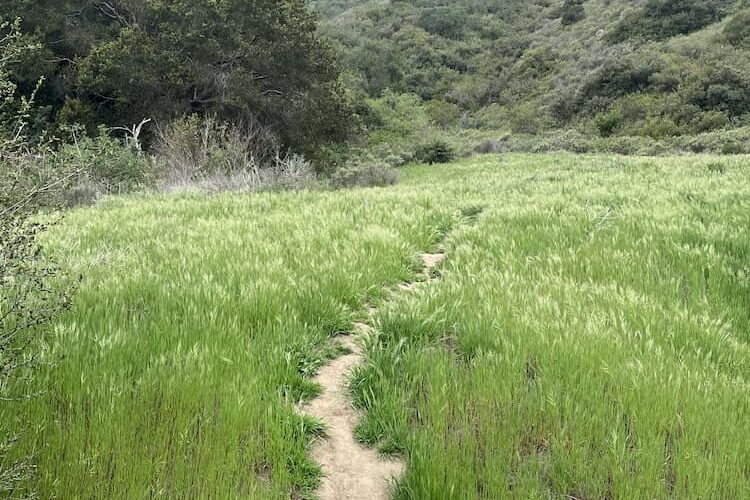
Aliso and Wood Canyons Wilderness Park
Only 3 days after I set foot on American soil, I found myself waking up to an early 7:00 am alarm. Still suffering from my jetlag, I somehow managed to get out of bed, take a shower and prepare my backpack. Shortly after, a quick 30-minute drive on Interstate 5 (south) brought me right to the official parking lot of the wilderness park.
Sleepy but extremely excited, it took me a few minutes to orient myself and finally discover the machine that provided me with a valid full-day parking ticket for only 3 USD.
Best Tips & Tools to Plan Your Trip
Once I placed the ticket visibly onto the dashboard of my car, I walked past the visitor center and stepped on a paved road called “Aliso Creek Trail”.
I followed that street for about 15 minutes and started to already get a bit bored at this point. There was not really anything to see and the fact that I was walking on concrete did not really make me feel like I was on a nature adventure.
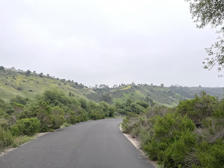
Wood Canyon Trail
However, not much later, after about 5 more minutes, there was an opening to my right. I left the concrete street, checked the map in front of me and decided to follow the “Wood Canyon Trail”, from which all smaller trails of the park branch off.
Cave Rock
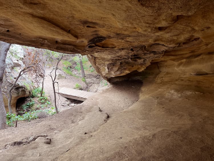
After only a few minutes of moderate walking, a sign post to my left directed me to “Cave Rock”. Although I did not know it in this very moment yet, this place would later be my favorite spot of the entire hike. A brief 5-min detour brought me to a beautiful sandstone cavity along the hillside, surrounded by deep green meadows.
Due to the climate and extensive heat in South California, such a “colorful” scenery can only be observed during a very small period of time. Soon after my visit, the beautiful green color would fade away and leave only dead yellow grass behind.
One reason more for me to fully appreciate this moment. I sat down for about 30 minutes, just to listen to the sound of nature while staring at the amazing scenery around me.
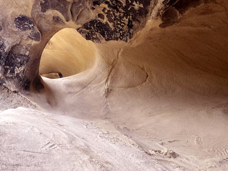
Dripping Cave
After heading back to “Wood Canyon Trail”, I continued to the next junction, which had a sign post pointing me to “Dripping Cave”, a huge sandstone overhang that was carved out by the ocean millions of years ago and presumably served as a frontier hideout for robbers in the 70s. Since it had not rained for a while before my arrival, the cave was unfortunately not “dripping”.
Even though this cave was much bigger, I liked “Cave Rock” way more due to its picturesque scenery. I decided to not spend much time in the shade of the forest surrounding the cave and followed “Wood Canyon Trail” further up until I reached yet another junction.
Car Wreck Trail
This time, I had to choose whether I wanted to continue on my current path or move over to “Car Wreck Trail”, which was labeled as “difficult”. The name itself made me already want to do it, but since I ran out of water a while ago (yes, that happens to me a lot!), I felt like I should reconsider this decision for a second.
The phase of consideration lasted about 5 seconds and I was on my way. As the jetlag was catching up, I also started to notice the intense heat. Due to the fact that I was walking inside a canyon, there was obviously little to no wind and I felt like being in an oven.
Just as I was about to get annoyed with the complicating circumstances, I remembered the weather I left behind in Germany and happily moved on.
Right at the beginning of the trail, I was still walking on a very narrow but comfortable footpath, which led me through the same kind of green meadows I loved so much at “Cave Rock”.
Suddenly, a deer appeared in the tall grass to my right and crossed the hiking path in front of me really quickly. As I slowed down, I noticed a second deer that seemed to have the intention of following the first one, but was too shy to make a move.
“Time for a little break anyways” I thought and sat down to wait it out. After about 10 seconds the second deer started to cross the hiking path. However, not as fast as the first one.
While keeping an eye on me, it slowly walked into the grass to my left and even stood there for a little bit. The deer kept its eyes on me as I began to continue my hike. What an emotionally fulfilling moment for someone that loves animals as much as I do.
After I was done with my lovely deer-experience, it slowly became clear to me why this particular hike was labeled as “difficult”. The path quickly became less even, more rocky and increasingly steep. As I arduously moved forward, one more thing became clear to me: The reason why the loop was called “Car Wreck Trail”.
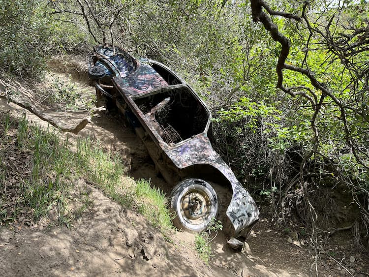
Entirely unexpected and far away from any road, I suddenly stood in front of a car wreck, which I believe to be an old Dodge coupe. The car was heavily decayed and partly embedded in the mountain. Although there is not much more to see than the car wreck itself, this site sure serves as an awesome opportunity to take some unusual pictures.
Once I was done taking about 75 pictures of the car wreck, I moved on. Although I was exhausted and dehydrated, I still wanted to finish this trail/loop. Retrospectively, I should have turned around. What followed after the car wreck was now a 250-meter incline that led to the turning point at the top of the mountain.
This part now became really hard. Not only did the incline itself and the heat make it unbearable, but the rocky surface of the ground (at this point, I would not even call it “trail” anymore) also made it very likely to slip and therefore easy to hurt myself.
Mathis Canyon Trail
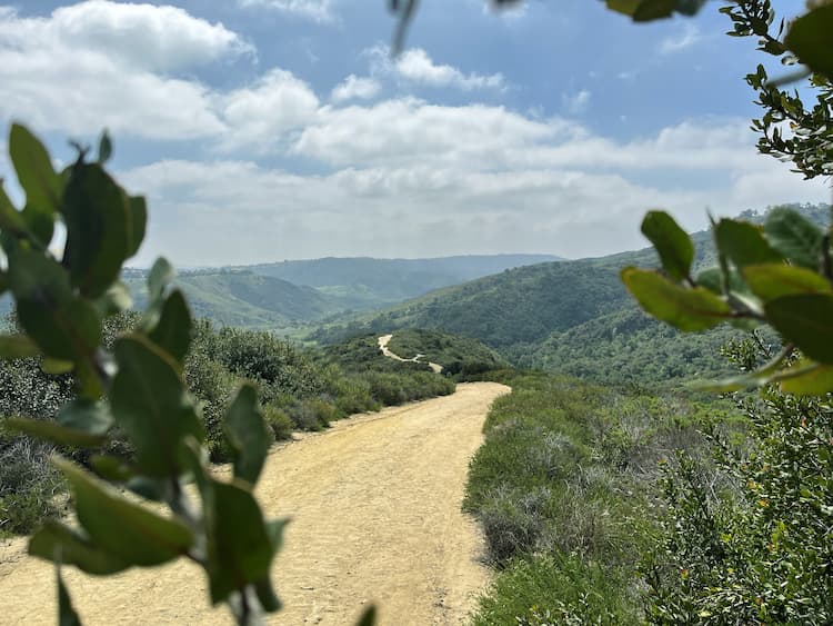
After a long and slow final stretch, I rested on top of the hill for about 20 minutes. Once I caught my breath, I started my descent on “Mathis Canyon Trail”. Despite the name, there was no canyon to see throughout the entire way down, which, luckily, only took about 15 minutes. Back on “Wood Canyon Trail” I made my way back towards the car.
As soon as I reached the concrete road again, I saw many people on mountain bikes now. A bicycle sure would have been nice at this point. After 3 hours and about 1000 kcal burned, I finished a hike that could best be labeled as “exercise with a view”.
In summary, I highly recommend a trip to the Aliso and Wood Canyon Wilderness Park for anyone that is looking for a non-touristy and peaceful getaway from the stressful and hectic city life. This park offers a variety of easy trails as well as moderate and difficult trails for both hikers and mountain bikers.
Pros: Lots of wildlife and flowers, great selection of trails, secluded and non-touristy, close to the beach for a post-hike cool down. Cons: Walking 20 minutes on a concrete street is inevitable to get to the actual trails, party too many bikers speeding downhill on narrow trails for hikers, risk of injury on difficult trails, dangerous heat and risk of dehydration.
Plan This Trip to Aliso and Wood Canyon Wilderness Park
Are you ready for your nature getaway? I highly recommend to start your hike early for several reasons. First, you will have more privacy and time for yourself. Second, you will avoid the midday sun and, hence, lower your risk of heat exhaustion.
Lastly, your chances of spotting wild animals are much higher in the morning, when not many people walked the trails yet. For detailed maps and further information about picnic areas, the trails, bird watching or scenic overlook locations, check out the official government website of OC parks.
Inspire your next adventure with our articles below:
Author Bio: Thomas Später is an experienced backpacking traveler that specializes in adventurous trips around the globe. He has traveled to remote and exotic places, such as Namibia or Mongolia and focuses on landscape and wildlife photography to share the beauty of our planet with others. In 2021, Thomas published a (german) book about Overpopulation and overconsumption (Die Überbevölkerung). With his awareness of current global issues, he uses his travels to support particularly local hotels and restaurants to raise awareness for the nature and culture of his destinations.

